Thursday, January 14, 2010

Dunedin and Mt. Cook National Park

After our restful week in Queenstown we headed east to Dunedin. This is the train station, the second most photographed building in the southern hemisphere. Besides looking at the unique Scottish architecture there are two very important things to do here.

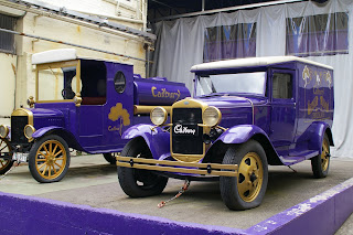
The first one is The Cadbury Tour. Unfortunately because of the summer holidays the factory wasn't producing chocolate. But we did get to see one ton of chocolate drop just because and taste freshly warmed chocolate. Yum!
The second one is to tour the Speight's Brewery. This brewery was founded in 1876 and is the south's top brewery. It's the drinking choice for every "Southern Man". This is John's new "southern man" coozie. Now all he needs is a Speight's Gold Medal Ale to go with it!

It just so happened that we visited this brewery on a very special day. John's 27 birthday! Happy Birthday John! Our new UK friend Mark helped us celebrate.

On our way up the coast we found a Yellow Eyed Penguin colony. Their chicks are about 8 weeks old, so the adults spend all day at sea fishing. In the evening they come to shore to feed their chicks. We watched them come into shore from fishing out at sea all day. This is two of them greeting each other.

Here are four of them discussing their eventful days out at sea.

The Moeraki Boulders are giant spherical rocks formed by a gradual buildup of minerals around a central core.

Does John look like he is being hatched out of the boulder? :)

Later that evening we got to see a Blue Penguin colony. These penguins come to feed their young about an hour after the sun has set. Just when it is too dark to get a good photo. They get blinded by the camera flash. So pretend this is a Blue Penguin crossing the road.

We then ventured inland to the other side of the great Southern Alps. We camped a very chilly night nearby the base of Mt. Cook and Mt. Sefton in Mt. Cook National Park. We awoke to a beautiful day with fresh snow on the peaks!

The tall pointy one with the fresh snow is Mt. Cook, the tallest mountain in New Zealand at 3754 meters.

Black Betty is enjoying the view.

We did an amazing hike up the Mueller Hut track. Yes, that tiny path curving around the side of the mountain is the "trail".

Looking down the Hooker Valley from Sealy Point.

Looking up the Hooker Valley at Sealy Point. The lake in the background is coming from the Hooker Glacier. That dirty patch of what looks like snow just beyond the lake is the Hooker Glacier.

Us at Sealy Point. The lake in the foreground is coming from the Mueller Glacier. The dirty patch of what looks like snow to the left of us is the Mueller Glacier.

A storm rolled in just as we made it to the ridge. Of course it started snowing!

We made it!


We made a snowman on the way down. It would have been bigger, but it started snowing harder. So our responsible selves decided it was better to get off the ridge rather than play in the snow.

The storm cleared later that evening and we got to see Mt. Sefton with the fresh snow. Beautiful!

Friday, January 1, 2010

Milford Sound and Queenstown

We drove straight through Wanaka, Queenstown, and Te Anau toward Fiordland National Park. The Milford Highway lead us directly to the spectacular Milford Sound.


The Homer Tunnel is 2km long and barely two cars wide. During the day there is a stoplight for traffic to take turns going through. After 6pm the stoplights turn off so we had to go through very carefully. Also, there aren't any lights in the tunnel!


We camped at a campground 3km from the end of the road. The next morning we took the first boat out into the water. It was a 60 passenger boat with about 20 people on it. Milford Sound was very mystical. The clouds were hanging low, the water was smooth as glass, and the air was saturated with moisture.


At Milford Sound it rains 183 days a year. They get 7 meters of rain annually. They get so much rain that there is a layer of freshwater on top of the salt water.


Because of all the rain there were waterfalls everywhere!


This is the boat vibration in a cup of coffee. Cool, huh!


Latitude 45 degrees south of the equator.


After Milford Sound we continued our journey south to Invercargill. We found a Christmas Eve candle light service to go to. This photo was taken right before we went in for a 9:30pm service (notice that the sun is still setting).

Our Christmas Eve "candles" (glow sticks).

Merry Christmas! Our Christmas stockings in the van. Tasty licorice and chocolate!

We still believe in Santa Claus! We woke up to chocolate Santa lollies (candy) on the van Christmas morning. :)

On Christmas Day, on our way back to Queenstown, we visited The Remarkables ski field. The 13km, each way, dirt road led us to the field. There were 3 chairlifts and the entire ski field is above tree line.

Beautiful Lake Wakatipu. This is the view from downtown Queenstown. We stayed here for 8 days!

Adventure Time! We rode on the Shotover Jet up the Shotover river through the canyon. This jet boat can operate in as little as 10 cm of water. It pumps out 800 liters of water a second from both jets. And it turns around 360 degrees! Crazy fun.

Then we hiked up 1500 feet to get a wonderful view of the lake. For those less adventurous there is a gondola that will take you to the same location.

View of Queenstown from the top. Wow!

Happy New Year! Fireworks and drinks in downtown Queenstown with new friends.

Monday, December 28, 2009

The Untamed West Coast

After we picked up Black Betty, we started our adventure for the untamed west coast of New Zealand. This is Lake Rotoiti near St. Arnaud in Nelson Lakes National Park.

No elk or deer on the road here!

The star of Paparoa National Park is the Pancake Rocks. These are limestone cliffs that are slowly being eroded and shaped by the Tasman Sea.

During high tide, the Tasman Sea sends sprays of water through the blowholes. Many people watching get wet!

John battled the fierce sandflies twice so we could have yummy spaghetti for dinner!


This is Lake Mapourika, we camped here. It's just north of Franz Josef.

The Southern Alps from Franz Josef.

There is a permanent snow field high in the Southern Alps feeding down to two easily accessible glaciers. The first one is Franz Josef. An hour hike led us to a point about 60 meters from the terminal face of the Franz Josef glacier.

The second glacier is Fox Glacier. We hiked through a very dense rainforest to the viewing platform on the south side of the Fox Glacier.

Then we hiked to the dramatic terminal face of the Fox Glacier.

There was a rainstorm a few weeks ago. A huge chunk of the terminal face of the glacier broke off. There are still pieces floating in the river. John was lucky enough to find one of these floating ice chunks.

Lake Matheson is known for its reflections of the Southern Alps. The water wasn't calm enough for us to get a million dollar reflection photo, but we still got a good one of the lake and mountains.

Rock slide detour.

Driftwood on the beach at Bruce Bay.

We turned inland at Haast, where we went over Haast Pass and onward toward Queenstown. This was our camping spot at Cameron Flat on Haast Pass. What a view!